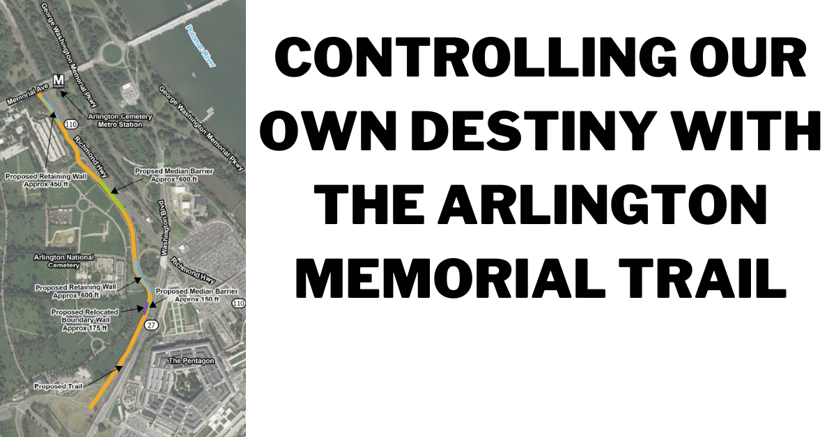
The Northeast Corner of Arlington County is dominated by large, powerful landowners and few transportation connections for people walking and rolling. As a result, over the last 15 years, low-stress biking and walking routes in this area have gotten worse, rather than better. Walking & biking through Joint Base Myer-Henderson Hall was restricted to CAC holders in 2015. The ability to walk & bike through Arlington National Cemetery (described by many old-timers as the most beautiful and emotionally touching commute around) was ended in 2016. The two main remaining walking & biking connections in the area - the 27 Trail and the wooden bridge to LBJ Grove rely on public access to the Pentagon Reservation which could be revoked at any time.
For these reasons & more, it is critical that Arlington County complete the proposed Arlington Memorial Trail - a new trail connection that would travel along the west side of Route 27 & the north side of Route 110 connecting Columbia Pike to Memorial Drive & onward to Memorial Bridge, DC, the Mt Vernon Trail, Rosslyn & other important destinations. Being almost exclusively in VDOT right-of-way, the Arlington Memorial Trail would ensure that this critical north-south corridor for walking & biking remains accessible despite any future shifts in the Pentagon security posture.
Arlington County and the Federal Highway Administration are beginning the Environmental documentation for this critical trail connection and are seeking your feedback on the overall project and on two potential alignment alternatives. See below for our suggested feedback supporting the connection & pointing out the highlights and problems with each alternative. Take action today - email your feedback to eden.jemal@dot.gov
I am writing today with support for the Arlington Memorial Trail as well as with feedback on the two proposed alternatives. The Arlington Memorial Trail would be an important north-south connection for people walking, biking, scooting & rolling in an area filled with barriers to this sort of travel. In 2015 we lost the ability to travel through Fort Myer. In 2016 we lost the ability to travel through Arlington National Cemetery. The ability to get from Columbia Pike to the Mt Vernon Trail and the bridges to DC without a major detour now requires entering the Pentagon Reservation, which requires consenting to being searched at any time and public access to the Pentagon Reservation could be ended at any time.
The Arlington Memorial Trail would provide a direct connection between Columbia Pike and the memorial core of DC that is safer, more pleasant, and more direct than the two substandard routes that exist today & ensure this connection continues no matter what changes may occur to security policy at the Pentagon.
Important Design Considerations for the Trail:
- Provide sufficient & consistent width & sight lines to prevent conflict between people walking and biking and to allow safe passing.
- Provide significant separation between the trail and highways like Route 27 and 110 to limit trail users exposure to vehicle emissions and noise pollution and barriers to shield trail users for blinding headlight glare.
- Use a long-wheel-base bicycle like a long-tail, bakfiets, or bicycle pulling a trailer as the design vehicle for the trail geometry to ensure curves, intersections, curb cuts, and other features all work for these longer trail user vehicles.
- Keep grade changes gradual to ensure the trail works for a wide variety of trail users.
- Provide a safe and direct crossing over Memorial Drive to facilitate connections from the Arlington Memorial Trail to the existing trail on the other side of Memorial Drive that would connect trail users to the US Marine Corp War Memorial & onward to Rosslyn & the Key Bridge.
- Dark-sky-compliant lighting that provides a consistent level of illumination for trail users.
Feedback on Presented Alternatives:
Sheet 4: Strongly prefer how ALT 2 relocates a portion of the Cemetery Wall to allow a consistent width for the trail and separation from the trail and the crash barrier. The narrowed trail of ALT 1 further suffers from the placement of the crash barrier immediately adjacent to the trail surface which functionally narrows the trail further as trail users are loathe to use the portion of the trail immediately adjacent to a vertical barrier.
Sheet 5: Strongly prefer how ALT 1 maintains better separation from Route 110. ALT 2's proximity to 110 would needlessly expose trail users to vehicle emissions & noise pollution from the highway as well as creating a less comfortable trail experience.